Integration of Remote Sensing and GIS in Studying Vegetation Trends and Conditions in the Gum Arabic Belt in North Kordofan, Sudan
Hassan Elnour Adam, Elmar Csaplovics
Hassan Elnour Adam
Integration of Remote Sensing and GIS in Studying Vegetation Trends and Conditions in the Gum Arabic Belt in North Kordofan, Sudan
158 Seiten. Format: B5. Broschur. Sprache: Englisch.
Preis: 28,00 Euro.
ISBN 978-3-941216-58-7
RHOMBOS-VERLAG, Berlin 2011.
Band 8 der Reihe „Fernerkundung und angewandte Geoinformatik“. Herausgegeben von Univ. Prof. Dr. habil. Elmar Csaplovics, Lehrstuhl Remote Sensing, FR Geowissenschaften, TU Dresden
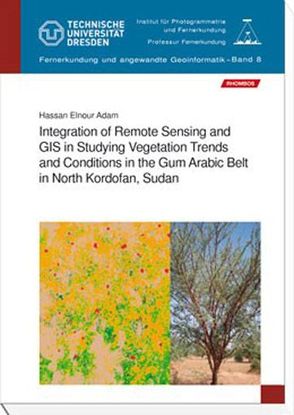
The gum arabic belt in Sudan plays a significant role in environmental, social and economical aspects. The belt has suffered from deforestation and degradation due to natural hazards and human activities. Data bases of land cover and vegetation can be used to develop maps of habitat suitability (digital vegetation map) including information on forest cover and canopy structure. Remote sensing offers a quick and efficient approach to the classification and mapping of land use land cover in a basis for future planning. This study used remotely sensed imagery to identify and delineate various land use land cover categories and types of vegetation cover present in the gum arabic belt in Kordofan region using recent methodologies of classification such as sub-pixel approach using object-based approach. Also, the integration of terrestrial forest inventory and remotely sensed data for the estimation of forest stand parameters of Acacia senegal trees was tested. The study integrated data from different sources and used different methods and approaches to analyse the long term land use land cover changes and trends during the previous three decades in the gum arabic belt in Kordofan State. The approach includes imageries from different satellites (Landsat and TERRA) for multi-temporal dates and integrated to fieldwork (forest inventory).
A vegetation maps are derived as an approach for vegetation evaluation, which is required for the effective management of natural resources in Kordofan region. The land cover modifications in condition and composition of vegetation cover as important aspects of change are considered in current research, as well as providing forest managers with more current and improved data for the purposes of forest inventory. The research contributes to the fundamental concerns of resources management including forestry and land use with developed approaches and methodologies using remote sensing and GIS and providing useful information for specific purposes.
